This simple utility converts UK National Grid references to geodetic coordinates (latitude & longitude) and displays the "QTH locator" reference used by radio hams. Don't know your National Grid reference? see below!
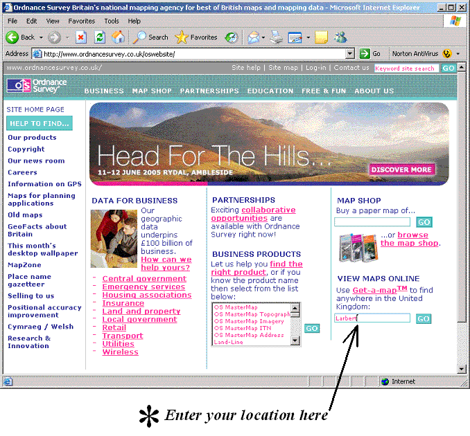
Enter your location (name of town or area, or postcode) in the box at the bottom right of the screen (I have used Larbert, an obscure suburb of Falkirk about 20 miles west of Edinburgh, for my example screens) and click "GO".
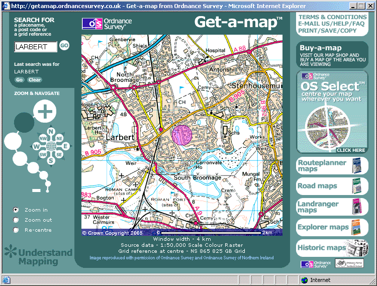
A new window will open showing an extract from the 1:50,000 "Landranger" map (the modern metric equivalent of the old "one-inch" maps) covering your area:
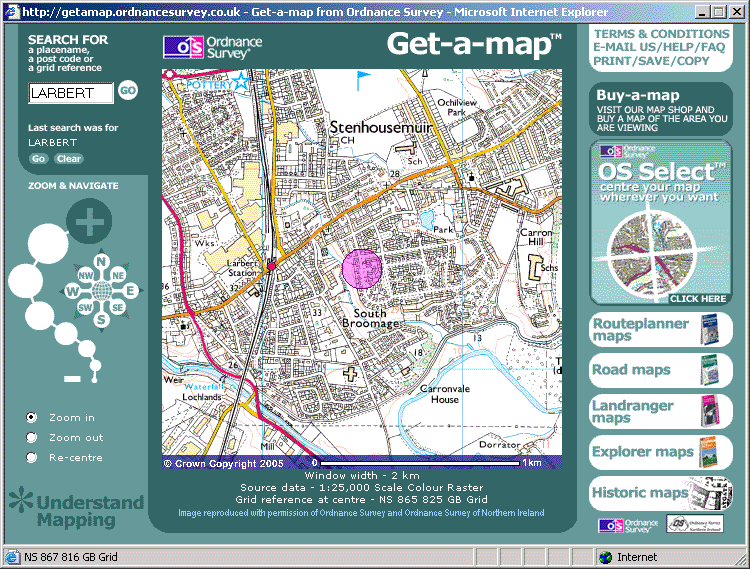
Click the large "+" in the "ZOOM & NAVIGATE" panel at the left of the window. This will change the display to an extract from the 1:25,000 "Explorer" map (the modern metric equivalent of the old "two-and-a-half-inch" maps) covering your area:
If the map-extract displayed does not include your location, use the controls marked with compass-points N, NE, E, SE etc to pan the map to find your home. You can get rid of that annoying pink circle by clicking "Clear" above the large "+".
When you have found your location, move the cross-hair cursor to it; the 6-digit National Grid reference will be shown in the status line at the bottom of the window (in my example it is showing NS867816). Please note that for places in Northern Ireland, the Ordnance Survey website gives Irish Grid references which are not comaptible with my QTH calculator.
A note on precision
A 6-digit National Grid reference is accurate to within 100 metres in both eastings and northings, and so each coordinate may be up to ±50m in error. Now, 50m of grid eastings are equivalent to about 2·5" of longitude at 50°N and 3·2" of longitude at 60°N, and 50m of grid northings are equivalent to about 1·6" of latitude anywhere in the UK. The consequence of this is that when you convert your grid reference into latitude & longitude, you may be several arcseconds away from you think you are.
This will not affect you unless your location happens to be within 100 metres of a locator-square boundary. QTH locator-squares measure 5' of longitude from west to east and 2·5' of latitude from south to north, so it will not affect you unless your longitude is within a few arcseconds of a 5' longitude boundary or your latitude is within a few arcseconds of a 2·5' latitude boundary.